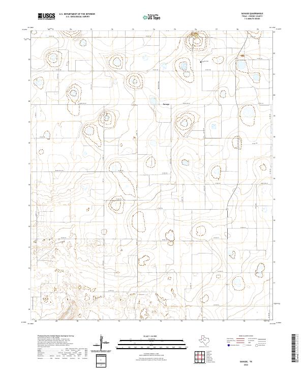
2022 Map of Savage
USGS Topo · Published 2022About this map
Emma Cem sits in the northern reaches of this Crosby County landscape, a quiet marker of the region's early settlement history. This area near Savage is characterized by its orderly grid of agricultural roads and the winding path of Plum Cr in the southwest. The presence of significant rural thoroughfares like Ranch Rd 40 and FM 1525 highlights the area's ongoing importance to Texas ranching and farming operations. The terrain is marked by numerous small depressions and playas, common to the Llano Estacado, which define the local drainage patterns and land use. For those researching the geography of the High Plains, this survey provides a modern snapshot of a sparsely populated but deeply rooted community structure.
Find a feature on this map
35 named features on this map. Tap any name to fly to it.
Don’t see what you’re looking for? This feature index may not catch every label — zoom into the map to look around manually.
Map Details
Editions of this 2022 Savage Map
This is the sole edition of this map. No revisions or reprints were ever made.
Other maps of this area

1954 · Lubbock
USGS Topo · 1:250,000

1965 · Acuff
USGS Topo · 1:24,000

1965 · Slaton NE
USGS Topo · 1:24,000

1965 · Lorenzo
USGS Topo · 1:24,000

1966 · Cap Rock
USGS Topo · 1:24,000

1966 · Canyon Valley
USGS Topo · 1:24,000

1967 · Ralls SE
USGS Topo · 1:24,000

1967 · Ralls NE
USGS Topo · 1:24,000

1967 · Ralls
USGS Topo · 1:24,000

1967 · Savage
USGS Topo · 1:24,000