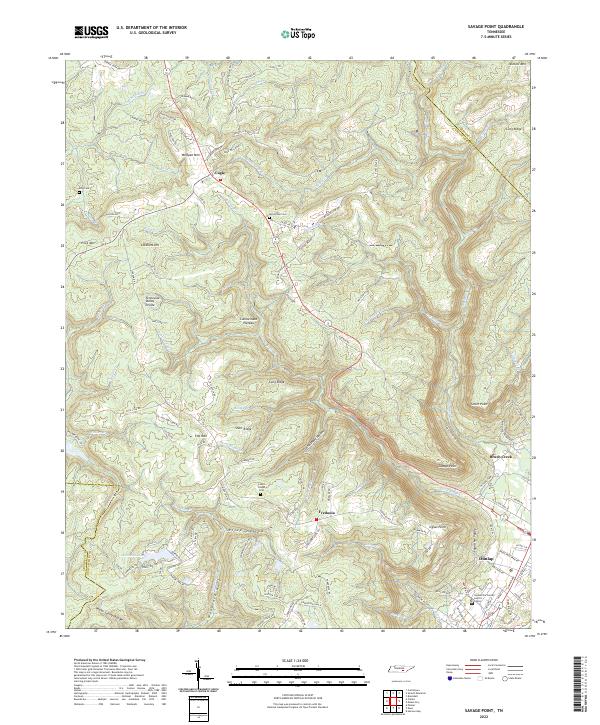
2022 Map of Savage Point
USGS Topo · Published 2022About this map
Sequatchie Valley dominates the southeastern quadrant of this landscape, providing a sharp topographic contrast to the surrounding Cumberland Plateau. The transition from the high plateau down into the valley is marked by dramatic features like Savage Point and Signal Point, where the land drops away towards the settlement of Dunlap. Historically, the plateau surface supported dispersed communities such as Cagle and Fredonia, connected by winding routes like Fredonia Rd. Family and community history is preserved at Lands Chapel and local burial grounds including McGlothen Cem and King Cem. The map also captures the local hydrography, with numerous branches like Bearwallow Cr and Little Brush Cr draining the plateau. Modern local governance is represented by the Sequatchie County Justice Center situated on the edge of the valley floor.
Find a feature on this map
133 named features on this map. Tap any name to fly to it.
Don’t see what you’re looking for? This feature index may not catch every label — zoom into the map to look around manually.
Map Details
Editions of this 2022 Savage Point Map
This is the sole edition of this map. No revisions or reprints were ever made.
Other maps of this area

1888 · Chattanooga
USGS Topo · 1:125,000

1892 · Pikeville
USGS Topo · 1:125,000

1893 · Mc Minnville
USGS Topo · 1:125,000

1893 · Chattanooga
USGS Topo · 1:125,000

1895 · Mc Minnville
USGS Topo · 1:125,000

1895 · Sewanee
USGS Topo · 1:125,000

1895 · Pikeville
USGS Topo · 1:125,000

1935 · Brockdell
USGS Topo · 1:24,000

1935 · Mount Airy
USGS Topo · 1:24,000

1935 · Smart Mountain
USGS Topo · 1:24,000