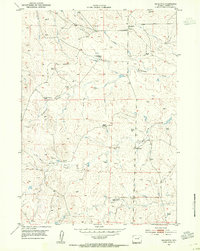
1953 Map of Savageton
USGS Topo · Published 1954About this map
Savageton serves as the primary landmark in this sparsely settled high plains landscape of Campbell County, Wyoming, during the early 1950s. The region is characterized by a network of established homesteads, including H Schlautmann Ranch, Lauby Ranch, and Gilbertz Ranch, which define the social and economic fabric of the area. Water management is a critical feature of these properties, as evidenced by numerous Windmill sites distributed across the undulating terrain to support livestock and habitation. The drainage systems of Greasewood Creek and Mud Spring Creek weave through the township, while a School (Aban'd) near Niles Ranch hints at a changing rural population. Published in coordination with the Atomic Energy Commission, the map provides a look at this ranching territory at a time when traditional homesteading patterns like the Camplin Ranch were being documented alongside early postwar geological interests.
Find a feature on this map
11 named features on this map. Tap any name to fly to it.
Don’t see what you’re looking for? This feature index may not catch every label — zoom into the map to look around manually.
Map Details
Editions of this 1953 Savageton Map
3 editions found
Other maps of this area

1953 · Savageton
USGS Topo · 1:24,000

1953 · Fats Draw
USGS Topo · 1:24,000

1953 · South Butte
USGS Topo · 1:24,000

1953 · Rolling Pin Ranch
USGS Topo · 1:24,000

1953 · North Butte
USGS Topo · 1:24,000

1955 · Newcastle
USGS Topo · 1:250,000

1958 · Newcastle
USGS Topo · 1:250,000

1959 · Savageton
USGS Topo · 1:62,500

1959 · North Star School
USGS Topo · 1:62,500

1960 · Turnercrest
USGS Topo · 1:62,500