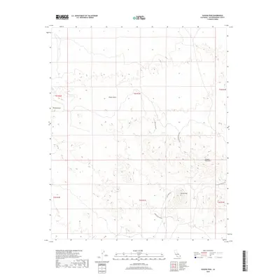
2018 Map of Savahia Peak
USGS Topo · Published 2018About this map
Savahia Peak and the northern reaches of the Whipple Mountains dominate this high-desert landscape in eastern San Bernardino County. The area is defined by its history of mineral exploration, evidenced by a network of specialized routes including Gold Hill Mine Rd, Gold Standard Mine Rd, and Cascade Mine No 2 Rd. These roads snake through the arid terrain of the Mojave Desert, providing access to remote claims and summits such as Pyramid Butte. The map's detail reveals the intersection of public land survey sections and the topographic contours that once challenged prospectors and early surveyors. Other notable access ways like Baily Mine Rd and Independence Mine Rd underscore the region's legacy of industrial effort and desert navigation.
Find a feature on this map
15 named features on this map. Tap any name to fly to it.
Don’t see what you’re looking for? This feature index may not catch every label — zoom into the map to look around manually.
Map Details
Editions of this 2018 Savahia Peak Map
This is the sole edition of this map. No revisions or reprints were ever made.
Other maps of this area

1911 · Parker
USGS Topo · 1:125,000

1943 · Whipple Mts.
USGS Topo · 1:62,500

1943 · Parker
USGS Topo · 1:62,500

1943 · Vidal
USGS Topo · 1:62,500

1949 · Parker
USGS Topo · 1:62,500

1949 · Vidal
USGS Topo · 1:62,500

1950 · Parker
USGS Topo · 1:62,500

1950 · Vidal
USGS Topo · 1:62,500

1950 · Whipple Mts
USGS Topo · 1:62,500

1950 · Savahia Peak
USGS Topo · 1:62,500