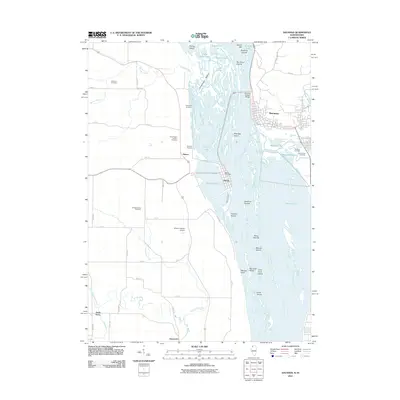
2011 Map of Savanna
USGS Topo · Published 2011About this map
Mississippi River waters dominate this 2011 survey, where the river braids into a complex network of backwaters and islands including Cavanaugh Bottom, Eldridge Island, and the Savanna Islands. The topography illustrates the vital connection between Savanna, Illinois, and the island community of Sabula, Iowa, linked by the Savanna-Sabula Bridge. This geography defines the local economy and transport, from the Sabula Post Office near the water's edge to the inland reaches of Beaver Creek and the Elk River.
Find a feature on this map
68 named features on this map. Tap any name to fly to it.
Don’t see what you’re looking for? This feature index may not catch every label — zoom into the map to look around manually.
Map Details
Editions of this 2011 Savanna Map
This is the sole edition of this map. No revisions or reprints were ever made.
Other maps of this area

1891 · Clinton
USGS Topo · 1:62,500

1892 · Goose Lake
USGS Topo · 1:62,500

1892 · Savanna
USGS Topo · 1:62,500

1894 · Goose Lake
USGS Topo · 1:62,500

1894 · Clinton
USGS Topo · 1:62,500

1899 · Clinton
USGS Topo · 1:125,000

1935 · Miles
USGS Topo · 1:62,500

1941 · Miles
USGS Topo · 1:62,500

1952 · Clinton
USGS Topo · 1:62,500

1952 · Savanna
USGS Topo · 1:62,500