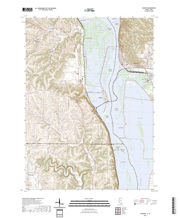
2024 Map of Savanna
USGS Topo · Published 2024About this map
The Mississippi River defines the complex geography of this border region, carving a labyrinth of islands and sloughs between Illinois and Iowa. Most of the riverine landscape is protected within the Upper Mississippi River National Wildlife and Fish Refuge, which encompasses numerous named landforms like Mound Island and Cavanaugh Bottom. On the Iowa side, the town of Sabula sits on a narrow peninsula surrounded by Sabula Lakes and the main channel, while the smaller settlements of Samoa, Teeds Grove, and Hauntown occupy the higher ground to the west.
Find a feature on this map
99 named features on this map. Tap any name to fly to it.
Don’t see what you’re looking for? This feature index may not catch every label — zoom into the map to look around manually.
Map Details
Editions of this 2024 Savanna Map
This is the sole edition of this map. No revisions or reprints were ever made.
Other maps of this area

1891 · Clinton
USGS Topo · 1:62,500

1892 · Goose Lake
USGS Topo · 1:62,500

1892 · Savanna
USGS Topo · 1:62,500

1894 · Goose Lake
USGS Topo · 1:62,500

1894 · Clinton
USGS Topo · 1:62,500

1899 · Clinton
USGS Topo · 1:125,000

1935 · Miles
USGS Topo · 1:62,500

1941 · Miles
USGS Topo · 1:62,500

1952 · Clinton
USGS Topo · 1:62,500

1952 · Savanna
USGS Topo · 1:62,500