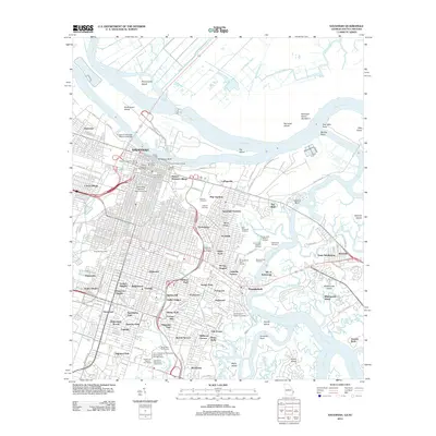
2012 Map of Savannah
USGS Topo · Published 2012About this map
The Savannah River serves as the focal point of this coastal landscape, where the historic core of Savannah meets an intricate network of islands and marshy channels. The city’s distinct layout is visible through landmarks like Telfair Square and the riverfront Factors Walk, while its academic legacy is anchored by Savannah State University and Armstrong Atlantic State University. The geography is defined by a series of significant landforms including Hutchinson Island and Dutch Island, separated by the Wilmington River and Back River.
Find a feature on this map
108 named features on this map. Tap any name to fly to it.
Don’t see what you’re looking for? This feature index may not catch every label — zoom into the map to look around manually.
Map Details
Editions of this 2012 Savannah Map
This is the sole edition of this map. No revisions or reprints were ever made.
Other maps of this area

1920 · Wassaw Sound
USGS Topo · 1:62,500

1920 · Bluffton
USGS Topo · 1:62,500

1942 · Savannah
USGS Topo · 1:62,500

1944 · Ossabaw Island
USGS Topo · 1:62,500

1945 · Bluffton
USGS Topo · 1:62,500

1945 · Ossabaw Island
USGS Topo · 1:62,500

1945 · Wassaw Sound
USGS Topo · 1:62,500

1946 · Brunswick
USGS Topo · 1:250,000

1947 · Savannah
USGS Topo · 1:250,000

1948 · Brunswick
USGS Topo · 1:250,000