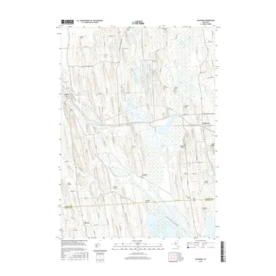
2016 Map of Savannah
USGS Topo · Published 2016About this map
The Clyde River and the historic Erie Canal define the watery corridor of this Central New York landscape, which includes the northern reaches of the Montezuma National Wildlife Reserve. This 2016 survey documents the intricate drainage patterns where Black Cr and Crusoe Cr feed into the Montezuma Marsh, surrounding unique geological formations like Crusoe Island and Hogback Ridge. The area is anchored by the village of Clyde in the west and Savannah to the east, with the small settlement of Lockpit marking a key point along the old canal route.
Find a feature on this map
102 named features on this map. Tap any name to fly to it.
Don’t see what you’re looking for? This feature index may not catch every label — zoom into the map to look around manually.
Map Details
Editions of this 2016 Savannah Map
This is the sole edition of this map. No revisions or reprints were ever made.
Other maps of this area

1899 · Auburn
USGS Topo · 1:62,500

1902 · Geneva
USGS Topo · 1:62,500

1902 · Clyde
USGS Topo · 1:62,500

1902 · Weedsport
USGS Topo · 1:62,500

1902 · Auburn
USGS Topo · 1:62,500

1943 · Lyons
USGS Topo · 1:31,680

1943 · Geneva North
USGS Topo · 1:31,680

1943 · Montezuma
USGS Topo · 1:31,680

1943 · Cayuga
USGS Topo · 1:31,680

1943 · Savannah
USGS Topo · 1:31,680