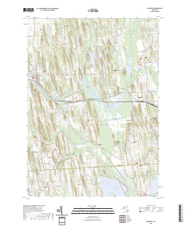
2023 Map of Savannah
USGS Topo · Published 2023About this map
Clyde and Savannah anchor this survey of the northern reaches of the Finger Lakes region, where the historical footprint of the Erie Canal remains a central feature of the landscape. The waterway is paralleled by relics of infrastructure like Clintons Ditch and the Trolley Rd, illustrating the layered history of New York’s transportation corridors. Much of the eastern and southern terrain is defined by the vast wetlands of the Montezuma National Wildlife Reserve and Montezuma Marsh, which surround isolated high ground such as Hogback Ridge and Crusoe Island. For local historians and genealogists, the map provides precise locations for several rural burial grounds, including Maple Grove Cem and the Pilgrims Rest Cem. The small settlement of Lockpit stands near the canal, while Fort Hill and Kelsey Hill rise above the surrounding swampy flats.
Find a feature on this map
67 named features on this map. Tap any name to fly to it.
Don’t see what you’re looking for? This feature index may not catch every label — zoom into the map to look around manually.
Map Details
Editions of this 2023 Savannah Map
This is the sole edition of this map. No revisions or reprints were ever made.
Other maps of this area

1899 · Auburn
USGS Topo · 1:62,500

1902 · Geneva
USGS Topo · 1:62,500

1902 · Clyde
USGS Topo · 1:62,500

1902 · Weedsport
USGS Topo · 1:62,500

1902 · Auburn
USGS Topo · 1:62,500

1943 · Lyons
USGS Topo · 1:31,680

1943 · Geneva North
USGS Topo · 1:31,680

1943 · Montezuma
USGS Topo · 1:31,680

1943 · Cayuga
USGS Topo · 1:31,680

1943 · Savannah
USGS Topo · 1:31,680