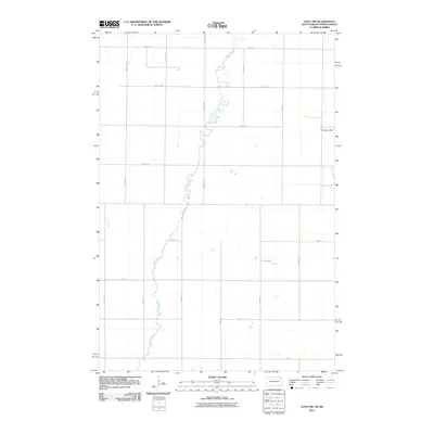
2011 Map of Savo NW
USGS Topo · Published 2011About this map
The Maple River meanders sharply through this agricultural landscape on the border of South Dakota and North Dakota. The terrain is defined by its extreme flatness, broken only by subtle features like Cannon Hill and small, scattered potholes or depressions typical of the regional prairie. The map shows a strictly regimented landscape where section lines and county roads, such as 98th St SE and 104th St, dictate the layout of rural farmsteads and transport. The river’s sinuous path contrasts with the rigid grid of North-South avenues like 387th Ave and 392nd Ave, highlighting the persistent tension between natural hydrology and the Public Land Survey System in this portion of the northern plains.
Find a feature on this map
22 named features on this map. Tap any name to fly to it.
Don’t see what you’re looking for? This feature index may not catch every label — zoom into the map to look around manually.
Map Details
Editions of this 2011 Savo NW Map
This is the sole edition of this map. No revisions or reprints were ever made.
Other maps of this area

1894 · Monango
USGS Topo · 1:62,500

1894 · Ellendale
USGS Topo · 1:62,500

1894 · Savo
USGS Topo · 1:62,500

1894 · Fullerton
USGS Topo · 1:62,500

1895 · Lamoure
USGS Topo · 1:125,000

1896 · Columbia
USGS Topo · 1:125,000

1896 · Edgeley
USGS Topo · 1:125,000

1899 · Ellendale
USGS Topo · 1:125,000

1918 · La Moure
USGS Topo · 1:125,000

1925 · Edgeley
USGS Topo · 1:125,000