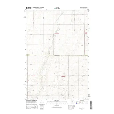
2015 Map of Savo NW
USGS Topo · Published 2015About this map
The Maple River snakes through the center of this rural landscape, crossing the state line between North Dakota and South Dakota. This 2015 survey highlights the border region where Dickey County and Brown County meet, showing a terrain defined by subtle elevation changes and prairie wetlands. The land is strictly organized by the Public Land Survey System, with a dense grid of gravel and section roads like 100th St and 390th Ave facilitating agricultural access. A notable topographical feature in the northeastern portion of the sheet is Cannon Hill, which stands out against the surrounding glacial till and river valley. The map documents the persistent agricultural footprint of the northern plains, where the Maple River remains the primary hydrological feature shaping the local geography.
Find a feature on this map
30 named features on this map. Tap any name to fly to it.
Don’t see what you’re looking for? This feature index may not catch every label — zoom into the map to look around manually.
Map Details
Editions of this 2015 Savo NW Map
This is the sole edition of this map. No revisions or reprints were ever made.
Other maps of this area

1894 · Monango
USGS Topo · 1:62,500

1894 · Ellendale
USGS Topo · 1:62,500

1894 · Savo
USGS Topo · 1:62,500

1894 · Fullerton
USGS Topo · 1:62,500

1895 · Lamoure
USGS Topo · 1:125,000

1896 · Columbia
USGS Topo · 1:125,000

1896 · Edgeley
USGS Topo · 1:125,000

1899 · Ellendale
USGS Topo · 1:125,000

1918 · La Moure
USGS Topo · 1:125,000

1925 · Edgeley
USGS Topo · 1:125,000