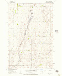
1956 Map of Savo NW
USGS Topo · Published 1957About this map
The Maple River meanders across this rural borderland during the mid-1950s, bisecting the boundary between Dickey and Brown counties and the state line between North Dakota and South Dakota. This prairie landscape is primarily defined by its township-based settlement patterns, specifically within Van Meter, Osceola, and Savo. A distinctive cultural layer is visible through the presence of rural gathering places like the Finnish Ch and Apostolic Ch, alongside several local schoolhouses including Maunu Sch and Alatalo Sch. The map reveals a shifting rural infrastructure with School No 2 and School No 3 already marked as out of use. To the east, the topography rises toward Cannon Hill, providing a stark contrast to the low-lying river drainage system that dominates the central portion of the quadrangle.
Find a feature on this map
14 named features on this map. Tap any name to fly to it.
Don’t see what you’re looking for? This feature index may not catch every label — zoom into the map to look around manually.
Map Details
Editions of this 1956 Savo NW Map
This is the sole edition of this map. No revisions or reprints were ever made.
Other maps of this area

1894 · Monango
USGS Topo · 1:62,500

1894 · Ellendale
USGS Topo · 1:62,500

1894 · Savo
USGS Topo · 1:62,500

1894 · Fullerton
USGS Topo · 1:62,500

1895 · Lamoure
USGS Topo · 1:125,000

1896 · Columbia
USGS Topo · 1:125,000

1896 · Edgeley
USGS Topo · 1:125,000

1899 · Ellendale
USGS Topo · 1:125,000

1918 · La Moure
USGS Topo · 1:125,000

1925 · Edgeley
USGS Topo · 1:125,000