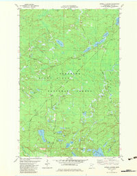
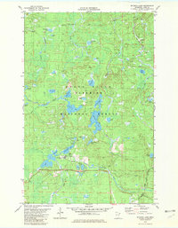
1981 Map of Sawbill Landing
USGS Topo · Published 1983About this map
Sawbill Landing sits at the heart of this Northwoods landscape, serving as a focal point for the regional timber and transport network within the Superior National Forest. The 1981 survey reveals a complex hydrological system defined by the Stony River and the winding Little Isabella River, interspersed with numerous glacial lakes such as Sylvania Lake and the notably named Doghouse Lake. Industrial infrastructure is visible through the Duluth and Missabe Iron Range railway line and several Gravel Pits that supported local road development. Transportation throughout this forested terrain relied on corridors like the Northwest Road and Trappers Lake Road, connecting remote points like Kelly Landing. The map illustrates the transition of the wilderness into a managed resource area, where the Dumbbell River and Dumbbell Lake drainage systems meet the infrastructure of the late twentieth-century forest economy.
Find a feature on this map
40 named features on this map. Tap any name to fly to it.
Don’t see what you’re looking for? This feature index may not catch every label — zoom into the map to look around manually.
Map Details
Editions of this 1981 Sawbill Landing Map
2 editions found
Other maps of this area

1954 · Two Harbors
USGS Topo · 1:250,000

1955 · Isabella
USGS Topo · 1:62,500

1955 · Cramer
USGS Topo · 1:62,500

1957 · Two Harbors
USGS Topo · 1:250,000

1958 · Two Harbors
USGS Topo · 1:250,000

1960 · Perent Lake
USGS Topo · 1:24,000

1964 · Two Harbors
USGS Topo · 1:250,000
1981 · Silver Island Lake
USGS Topo · 1:24,000
1981 · Isabella
USGS Topo · 1:24,000
1981 · Mitawan Lake
USGS Topo · 1:24,000
Featured Places
- Stony River Township, MN
- Wheeler Landing, MN
- Martin Landing, MN
- Kelly Landing, MN
- Crystal Bay Township, MN