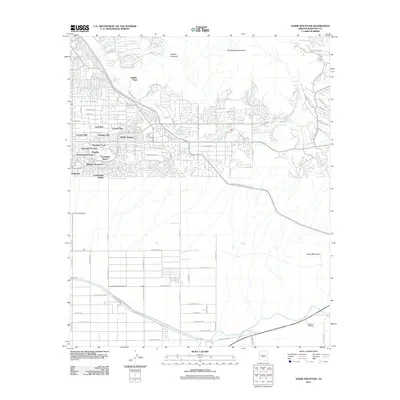
2011 Map of Sawik Mountain
USGS Topo · Published 2011About this map
Taliesin West, the winter home and school established by Frank Lloyd Wright, sits prominently at the base of the Mc Dowell Mountains in this early 21st-century documentation. The map illustrates the sophisticated suburban expansion into the desert landscape, where established developments like Scottsdale Ranch, Continental Village, and Mission Monterey interface with the natural topography. The rugged southeastern quadrant is dominated by Sawik Mountain, while drainage patterns like Taliesin Wash and Lost Dog Wash cut through the built environment.
Find a feature on this map
82 named features on this map. Tap any name to fly to it.
Don’t see what you’re looking for? This feature index may not catch every label — zoom into the map to look around manually.
Map Details
Editions of this 2011 Sawik Mountain Map
This is the sole edition of this map. No revisions or reprints were ever made.
Other maps of this area

1904 · Camelback
USGS Topo · 1:62,500

1904 · Desert Well
USGS Topo · 1:62,500

1904 · Ft. McDowell
USGS Topo · 1:62,500

1906 · Camelsback
USGS Topo · 1:62,500

1906 · Ft. McDowell
USGS Topo · 1:62,500

1906 · Desert Well
USGS Topo · 1:62,500

1913 · Mesa
USGS Topo · 1:62,500

1915 · Mesa
USGS Topo · 1:62,500

1930 · Cave Creek
USGS Topo · 1:125,000

1939 · Cave Creek
USGS Topo · 1:125,000