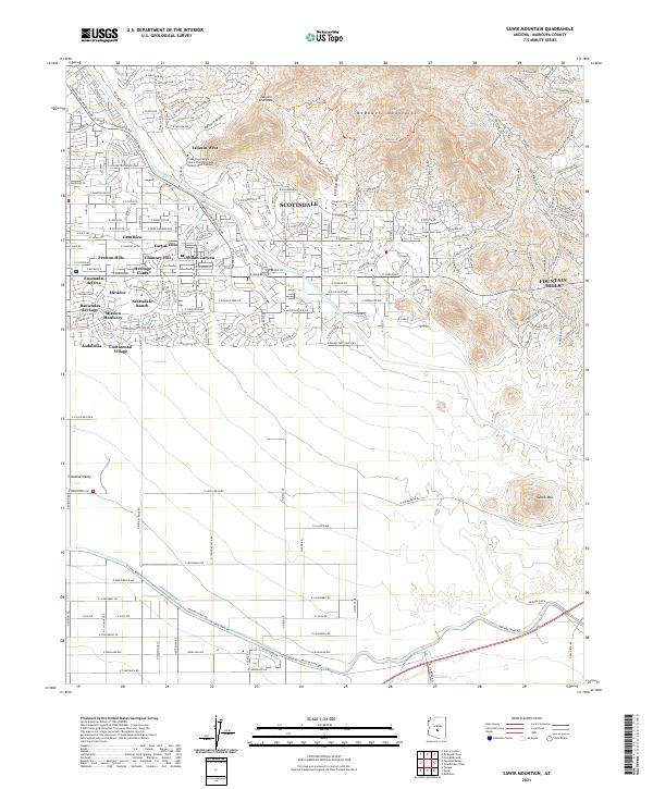
2021 Map of Sawik Mountain
USGS Topo · Published 2021About this map
Taliesin West, the winter home and laboratory of architect Frank Lloyd Wright, sits prominently at the base of the McDowell Mountains in this modern survey of the northeast Phoenix valley. The map documents the extensive residential development that has filled the desert floor, with named neighborhoods like Scottsdale Ranch, Casa Rica, and Haciendas del Lago creating a dense suburban grid. This built environment is defined by its relationship to water infrastructure, notably the Central Arizona Project Aqueduct and the historical Arizona Canal, which both cut across the landscape.
Find a feature on this map
149 named features on this map. Tap any name to fly to it.
Don’t see what you’re looking for? This feature index may not catch every label — zoom into the map to look around manually.
Map Details
Editions of this 2021 Sawik Mountain Map
This is the sole edition of this map. No revisions or reprints were ever made.
Other maps of this area

1904 · Camelback
USGS Topo · 1:62,500

1904 · Desert Well
USGS Topo · 1:62,500

1904 · Ft. McDowell
USGS Topo · 1:62,500

1906 · Camelsback
USGS Topo · 1:62,500

1906 · Ft. McDowell
USGS Topo · 1:62,500

1906 · Desert Well
USGS Topo · 1:62,500

1913 · Mesa
USGS Topo · 1:62,500

1915 · Mesa
USGS Topo · 1:62,500

1930 · Cave Creek
USGS Topo · 1:125,000

1939 · Cave Creek
USGS Topo · 1:125,000