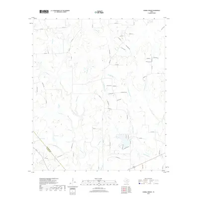
2019 Map of Sawmill Branch
USGS Topo · Published 2019About this map
The Colorado and Lavaca County boundary runs through this section of the Texas coastal plain, where the landscape is defined by a dense network of creek branches and small livestock water features. Scott Lake and Stockton Lake sit near the western edge of the quadrangle, serving as primary hydrological markers in a region where the terrain slowly descends toward the Gulf. The drainage patterns are intricate, with Sawmill Br and Panther Br feeding into larger systems like Middle Sandy Cr.
Find a feature on this map
70 named features on this map. Tap any name to fly to it.
Don’t see what you’re looking for? This feature index may not catch every label — zoom into the map to look around manually.
Map Details
Editions of this 2019 Sawmill Branch Map
This is the sole edition of this map. No revisions or reprints were ever made.
Other maps of this area

1919 · Schulenburg
USGS Topo · 1:62,500

1953 · Seguin
USGS Topo · 1:250,000

1956 · Glidden
USGS Topo · 1:62,500

1957 · Columbus
USGS Topo · 1:24,000

1957 · Borden
USGS Topo · 1:24,000

1958 · Seguin
USGS Topo · 1:250,000

1962 · Sublime
USGS Topo · 1:24,000

1965 · Oakland
USGS Topo · 1:24,000

1965 · Sawmill Branch
USGS Topo · 1:24,000

1965 · Rock Island
USGS Topo · 1:24,000