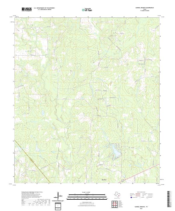
2022 Map of Sawmill Branch
USGS Topo · Published 2022About this map
Sheridan anchors the southern portion of this region, situated just north of the border between Colorado Co and Lavaca Co. The landscape is defined by an intricate network of waterways that converge as they flow south, including the W Sandy Cr, Middle Sandy Cr, and E Sandy Cr. These riparian corridors are fed by numerous smaller tributaries such as Sawmill Br, Alligator Br, and Panther Br, creating a complex drainage pattern throughout the county. In the western reaches, Stockton Lake and Scott Lake provide distinct landmarks along the course of Parker Cr. The map reveals a transition from broader cattle ranching lands, suggested by names like Hill Ranch Rd and Draper Ranch Rd, to residential developments indicated by more contemporary street names such as Shady Oaks Ln and Bluebonnet.
Find a feature on this map
75 named features on this map. Tap any name to fly to it.
Don’t see what you’re looking for? This feature index may not catch every label — zoom into the map to look around manually.
Map Details
Editions of this 2022 Sawmill Branch Map
This is the sole edition of this map. No revisions or reprints were ever made.
Other maps of this area

1919 · Schulenburg
USGS Topo · 1:62,500

1953 · Seguin
USGS Topo · 1:250,000

1956 · Glidden
USGS Topo · 1:62,500

1957 · Columbus
USGS Topo · 1:24,000

1957 · Borden
USGS Topo · 1:24,000

1958 · Seguin
USGS Topo · 1:250,000

1962 · Sublime
USGS Topo · 1:24,000

1965 · Oakland
USGS Topo · 1:24,000

1965 · Sawmill Branch
USGS Topo · 1:24,000

1965 · Rock Island
USGS Topo · 1:24,000