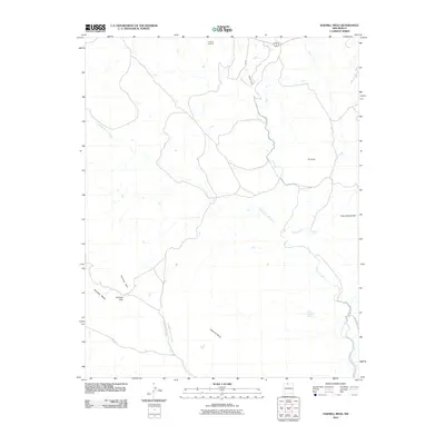
2010 Map of Sawmill Mesa
USGS Topo · Published 2010About this map
Sawmill Mesa and the prominent volcanic and erosional formations of Rio Arriba County define this New Mexico landscape. The topography is marked by significant geologic features including Tecolote Rim, Tecolote Mesa, and the passage at Tecolote Gap. Of particular note for local water management and infrastructure history is the Azotea Tunnel, part of the San Juan-Chama Project designed to divert water across the Continental Divide. Drainage patterns are dominated by the winding path of Willow Creek and the ephemeral flows through Cañada de Tio Roque. While largely an open landscape, small private holdings and developments such as Casa Escondida and V and M Ventures appear alongside rural routes like Co Road 335, reflecting contemporary land use in this high-altitude region.
Find a feature on this map
14 named features on this map. Tap any name to fly to it.
Don’t see what you’re looking for? This feature index may not catch every label — zoom into the map to look around manually.
Map Details
Editions of this 2010 Sawmill Mesa Map
This is the sole edition of this map. No revisions or reprints were ever made.
Other maps of this area

1954 · Aztec
USGS Topo · 1:250,000

1955 · Chama
USGS Topo · 1:62,500

1955 · Lumberton
USGS Topo · 1:62,500

1955 · Tierra Amarilla
USGS Topo · 1:62,500

1955 · Boulder Lake
USGS Topo · 1:62,500

1958 · Aztec
USGS Topo · 1:250,000

1962 · Aztec
USGS Topo · 1:250,000

1965 · Aztec
USGS Topo · 1:250,000

1981 · Chama
USGS Topo · 1:100,000
1983 · Monero
USGS Topo · 1:24,000