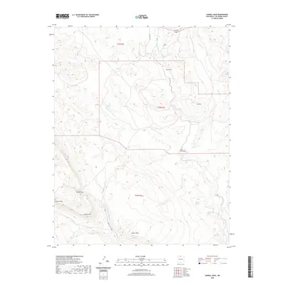
2020 Map of Sawmill Mesa
USGS Topo · Published 2020About this map
Sawmill Mesa and the surrounding high-elevation terrain of Rio Arriba County define this 2020 landscape, where natural water sources and modern infrastructure meet. A notable feature of the local engineering is the Azotea Tunnel, which cuts through the northern section of the map to facilitate water management across the Continental Divide. The topography is marked by significant rimrock and plateaus, including Tecolote Rim, Tecolote Mesa, and the prominent El Cerro.
Find a feature on this map
19 named features on this map. Tap any name to fly to it.
Don’t see what you’re looking for? This feature index may not catch every label — zoom into the map to look around manually.
Map Details
Editions of this 2020 Sawmill Mesa Map
This is the sole edition of this map. No revisions or reprints were ever made.
Other maps of this area

1954 · Aztec
USGS Topo · 1:250,000

1955 · Chama
USGS Topo · 1:62,500

1955 · Lumberton
USGS Topo · 1:62,500

1955 · Tierra Amarilla
USGS Topo · 1:62,500

1955 · Boulder Lake
USGS Topo · 1:62,500

1958 · Aztec
USGS Topo · 1:250,000

1962 · Aztec
USGS Topo · 1:250,000

1965 · Aztec
USGS Topo · 1:250,000

1981 · Chama
USGS Topo · 1:100,000
1983 · Monero
USGS Topo · 1:24,000