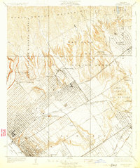
1925 Map of Sawtelle
USGS Topo · Published 1931About this map
The sprawling canyons and emerging subdivisions of West Los Angeles dominate this mid-1920s survey, illustrating a landscape in rapid transition from Mexican land grant ranchos to modern urban corridors. The massive grounds of the Soldiers Home and the adjacent town of Sawtelle anchor the central valley, surrounded by the historical remnants of San Jose de Buenos Ayres and Rodeo de Las Aguas. To the south, the early footprint of aviation history is marked at the Aviation Field near La Ballona, while the grid of Santa Monica meets the shore at the Municipal Pier.
Find a feature on this map
49 named features on this map. Tap any name to fly to it.
Don’t see what you’re looking for? This feature index may not catch every label — zoom into the map to look around manually.
Map Details
Editions of this 1925 Sawtelle Map
2 editions found
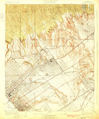
Other maps of this area

1894 · Los Angeles
USGS Topo · 1:62,500

1896 · Redondo
USGS Topo · 1:62,500

1896 · Santa Monica
USGS Topo · 1:62,500

1898 · Santa Monica
USGS Topo · 1:62,500

1900 · Los Angeles
USGS Topo · 1:62,500

1901 · Southern California Sheet No. 1
USGS Topo · 1:250,000

1902 · Santa Monica
USGS Topo · 1:62,500

1903 · Calabasas
USGS Topo · 1:62,500

1903 · Camulos
USGS Topo · 1:125,000

1904 · Southern California Sheet No. 1
USGS Topo · 1:250,000