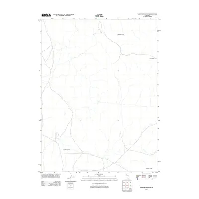
2011 Map of Sawtooth Knob
USGS Topo · Published 2011About this map
Sawtooth Knob serves as the focal point for this section of Humboldt County, where the high desert terrain is punctuated by critical water sources like Railroad Spring and Mitchum Spring. In the early 21st century, the landscape remains largely defined by its natural drainage patterns and the network of primitive roads that navigate the arid basins. The southern portion of the map transition into the Antelope Range, where the geography becomes increasingly complex as it meets Rosebud Canyon. This area, accessed via the long stretch of Pioneer Rd, illustrates the sparse infrastructure and the reliance on isolated springs and canyon passes for movement across the Great Basin. The presence of Box Canyon in the northeast further highlights the deep incisions carved into this high-elevation plateau.
Find a feature on this map
7 named features on this map. Tap any name to fly to it.
Don’t see what you’re looking for? This feature index may not catch every label — zoom into the map to look around manually.
Map Details
Editions of this 2011 Sawtooth Knob Map
This is the sole edition of this map. No revisions or reprints were ever made.
Other maps of this area

1931 · Lovelock
USGS Topo · 1:250,000

1935 · Lovelock
USGS Topo · 1:250,000

1955 · Lovelock
USGS Topo · 1:250,000

1959 · Lovelock
USGS Topo · 1:250,000

1971 · Majuba Mtn
USGS Topo · 1:24,000
1971 · Jungo
USGS Topo · 1:24,000
1971 · Long Canyon
USGS Topo · 1:24,000
1981 · Sawtooth Knob
USGS Topo · 1:24,000

1981 · Scossa
USGS Topo · 1:24,000

1981 · Placerites
USGS Topo · 1:24,000