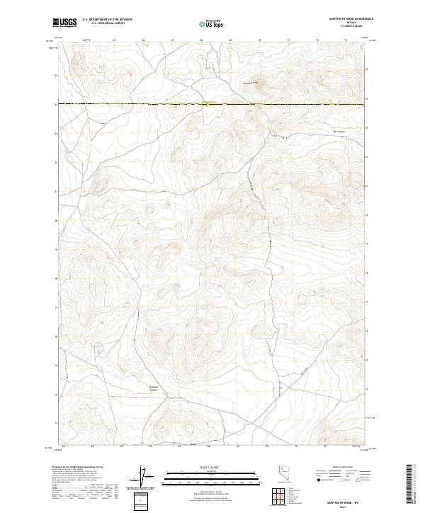
2021 Map of Sawtooth Knob
USGS Topo · Published 2021About this map
Sawtooth Knob serves as the central landmark for this high-desert region of northern Nevada, situated along the border of Humboldt Co and Pershing Co. The landscape is defined by its arid drainages and isolated water sources, which were critical for early transit and livestock in the Great Basin. Remote outposts such as Railroad Spring and Mitchum Spring indicate the essential water locations that supported regional movement between townships like t35n r31e and t34n r30e. Deep geographical features including Box Canyon, Rosebud Canyon, and the extensive Long Canyon illustrate the complex natural topography that challenged early surveyors and continues to define this section of the state's interior.
Find a feature on this map
13 named features on this map. Tap any name to fly to it.
Don’t see what you’re looking for? This feature index may not catch every label — zoom into the map to look around manually.
Map Details
Editions of this 2021 Sawtooth Knob Map
This is the sole edition of this map. No revisions or reprints were ever made.
Other maps of this area

1931 · Lovelock
USGS Topo · 1:250,000

1935 · Lovelock
USGS Topo · 1:250,000

1955 · Lovelock
USGS Topo · 1:250,000

1959 · Lovelock
USGS Topo · 1:250,000

1971 · Majuba Mtn
USGS Topo · 1:24,000
1971 · Jungo
USGS Topo · 1:24,000
1971 · Long Canyon
USGS Topo · 1:24,000
1981 · Sawtooth Knob
USGS Topo · 1:24,000

1981 · Scossa
USGS Topo · 1:24,000

1981 · Placerites
USGS Topo · 1:24,000