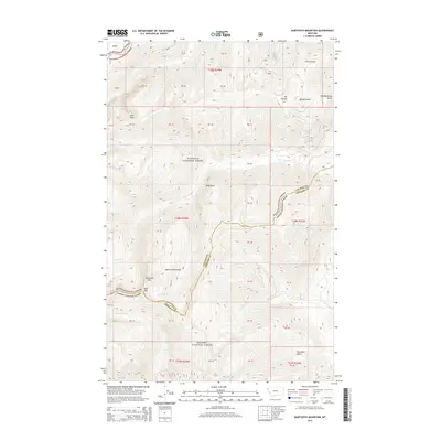
2014 Map of Sawtooth Mountain
USGS Topo · Published 2014About this map
The Cabinet Mountains dominate this landscape on the boundary of Lincoln and Sanders counties, a region of the northern Rockies managed by the Kootenai National Forest and Kanisku National Forest. The map captures a high-elevation environment defined by prominent peaks and sharp ridgelines, including Sawtooth Mtn and the distinctively named Bad Medicine Spires. Drainage patterns are clearly marked by the branching systems of Ross Cr and Dry Cr, which carve through steep terrain marked by features like Emma Gulch and Ross Point. This 2014 survey serves as a precise record of the landforms and forest boundaries, tracing the remote transition from Mt Vernon down into the valleys where Spar Cr and Club Cr flow through the deep timber of northwestern Montana.
Find a feature on this map
28 named features on this map. Tap any name to fly to it.
Don’t see what you’re looking for? This feature index may not catch every label — zoom into the map to look around manually.
Map Details
Editions of this 2014 Sawtooth Mountain Map
This is the sole edition of this map. No revisions or reprints were ever made.
Other maps of this area

1911 · Priest Lake
USGS Topo · 1:250,000

1913 · Priest Lake
USGS Topo · 1:250,000

1920 · Libby
USGS Topo · 1:125,000

1930 · Libby
USGS Topo · 1:125,000

1932 · Libby
USGS Topo · 1:125,000

1951 · Clark Fork
USGS Topo · 1:62,500

1951 · Mt Pend Oreille
USGS Topo · 1:62,500

1957 · Kalispell
USGS Topo · 1:250,000

1958 · Sandpoint
USGS Topo · 1:250,000

1960 · Kalispell
USGS Topo · 1:250,000