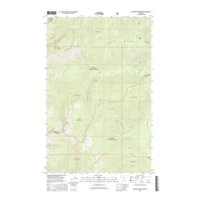
2017 Map of Sawtooth Mountain
USGS Topo · Published 2017About this map
Cabinet Mountains high peaks dominate this 2017 survey area along the border of Lincoln and Sanders counties. The landscape is defined by the hydrologic network of Ross Creek and its many tributaries, including the South Fork Ross Creek and North Fork Ross Creek. These waterways carve deep drainages through the Kootenai National Forest and Kaniksu National Forest, creating prominent landmarks like Ross Point and the sharp Bad Medicine Spires. Modern recreational infrastructure is represented by the Ross Creek X-C Ski trail system near the eastern edge. Geologic and topographic detail is high, mapping the relationship between summits like Sawtooth Mtn and Mid Mtn and the gulches such as Emma Gulch and Hamilton Gulch that feed the river system below.
Find a feature on this map
36 named features on this map. Tap any name to fly to it.
Don’t see what you’re looking for? This feature index may not catch every label — zoom into the map to look around manually.
Map Details
Editions of this 2017 Sawtooth Mountain Map
This is the sole edition of this map. No revisions or reprints were ever made.
Other maps of this area

1911 · Priest Lake
USGS Topo · 1:250,000

1913 · Priest Lake
USGS Topo · 1:250,000

1920 · Libby
USGS Topo · 1:125,000

1930 · Libby
USGS Topo · 1:125,000

1932 · Libby
USGS Topo · 1:125,000

1951 · Clark Fork
USGS Topo · 1:62,500

1951 · Mt Pend Oreille
USGS Topo · 1:62,500

1957 · Kalispell
USGS Topo · 1:250,000

1958 · Sandpoint
USGS Topo · 1:250,000

1960 · Kalispell
USGS Topo · 1:250,000