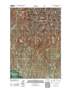
2011 Map of Sawtooth Ridge
USGS Topo · Published 2011About this map
Sawtooth Ridge and the volcanic geography of Sawtooth Crater dominate this high-desert landscape in Union County. The map documents a complex network of resource roads and water management systems, including the Big Creek Ditch and Gilkison Sawmill Rd, which reflect the region's historical reliance on timber and irrigation. In the southern portion, the terrain descends into the Lower Powder Valley, where the Powder River flows past Keating Grange Ln. Distinctive landmarks like Table Mountain and the Copper Buttes provide significant orientation points for those tracing the development of local ranching and mining routes. Numerous drainages such as West Fork Tucker Creek and Chicken Creek carve through the area, illustrating the essential relationship between the upland snowpack and the agricultural valleys below.
Find a feature on this map
29 named features on this map. Tap any name to fly to it.
Don’t see what you’re looking for? This feature index may not catch every label — zoom into the map to look around manually.
Map Details
Editions of this 2011 Sawtooth Ridge Map
This is the sole edition of this map. No revisions or reprints were ever made.
Other maps of this area

1901 · Baker City
USGS Topo · 1:125,000

1906 · Telocaset
USGS Topo · 1:125,000

1915 · Pine
USGS Topo · 1:125,000

1954 · Eagle Cap
USGS Topo · 1:62,500

1955 · Baker
USGS Topo · 1:250,000

1955 · Grangeville
USGS Topo · 1:250,000

1957 · Sparta
USGS Topo · 1:62,500

1959 · Baker
USGS Topo · 1:250,000

1959 · Grangeville
USGS Topo · 1:250,000

1965 · Flagstaff Butte
USGS Topo · 1:24,000