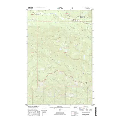
2017 Map of Sawtooth Ridge
USGS Topo · Published 2017About this map
Ashford sits along the northern edge of this survey, positioned near the gateway to the southern reaches of Mount Rainier National Park. The landscape is defined by the sharp elevations of Sawtooth Ridge and Osborne Mtn, which separate the drainage of the Nisqually River from the dense forest lands to the south. This area serves as a significant intersection of public lands, where the boundaries of the Snoqualmie National Forest and the Gifford Pinchot National Forest meet. Remote alpine water bodies like Cora Lake, Bertha May Lake, and Greenwood Lake are tucked into the high basins, while a network of Forest Service roads, including Nat For Dev Rd 84 and Nat For Dev Rd 85, provide the primary access through the steep terrain between High Rock and Griffin Mtn.
Find a feature on this map
50 named features on this map. Tap any name to fly to it.
Don’t see what you’re looking for? This feature index may not catch every label — zoom into the map to look around manually.
Map Details
Editions of this 2017 Sawtooth Ridge Map
This is the sole edition of this map. No revisions or reprints were ever made.
Other maps of this area

1924 · Mt Rainier
USGS Topo · 1:96,000

1928 · Mt Rainier
USGS Topo · 1:125,000

1937 · Eatonville
USGS Topo · 1:125,000

1950 · Yakima
USGS Topo · 1:250,000

1953 · Hoquiam
USGS Topo · 1:250,000

1956 · Mineral
USGS Topo · 1:62,500

1956 · Kapowsin
USGS Topo · 1:62,500

1957 · Hoquiam
USGS Topo · 1:250,000

1958 · Yakima
USGS Topo · 1:250,000

1958 · Hoquiam
USGS Topo · 1:250,000