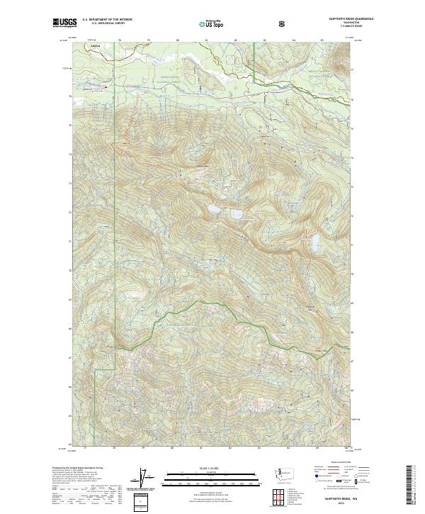
2023 Map of Sawtooth Ridge
USGS Topo · Published 2023About this map
Ashford sits at the northwestern edge of this landscape, serving as a gateway where the Nisqually River flows through the borderlands of major federal preserves. The terrain is defined by the steep elevation changes of the Snoqualmie National Forest and the Gifford Pinchot National Forest, with the high spine of Sawtooth Ridge dividing the watersheds. To the northeast, the map reaches into the Mount Rainier National Park and its accompanying Mount Rainier Wilderness, showing the early reaches of Tahoma Creek and Fenas Creek. This 2023 edition documents an extensive network of recreational and access routes, including the Osborne Mountain Trl and Teeley Creek Trl, which connect high-altitude water bodies like Cora Lake, Bertha May Lake, and Granite Lake. The map illustrates the contemporary balance between timber management and wilderness preservation in the South Cascades.
Find a feature on this map
49 named features on this map. Tap any name to fly to it.
Don’t see what you’re looking for? This feature index may not catch every label — zoom into the map to look around manually.
Map Details
Editions of this 2023 Sawtooth Ridge Map
This is the sole edition of this map. No revisions or reprints were ever made.
Other maps of this area

1924 · Mt Rainier
USGS Topo · 1:96,000

1928 · Mt Rainier
USGS Topo · 1:125,000

1937 · Eatonville
USGS Topo · 1:125,000

1950 · Yakima
USGS Topo · 1:250,000

1953 · Hoquiam
USGS Topo · 1:250,000

1956 · Mineral
USGS Topo · 1:62,500

1956 · Kapowsin
USGS Topo · 1:62,500

1957 · Hoquiam
USGS Topo · 1:250,000

1958 · Yakima
USGS Topo · 1:250,000

1958 · Hoquiam
USGS Topo · 1:250,000