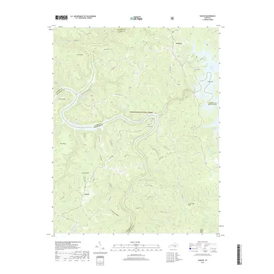
2019 Map of Sawyer
USGS Topo · Published 2019About this map
Sawyer and Baldrock anchor this rural landscape in McCreary County, where the convergence of the Cumberland River and Rockcastle River defines the local topography. This 2019 survey captures the area within the Daniel Boone National Forest, showing a network of ridge-top roads like Sulphur Road and high-ground settlements. Genealogists will find the locations of Hamilton Cem and Price Cem well-documented near the deeply carved river bends. The eastern portion of the map is dominated by the waters of Laurel River Lake, including the distinctive Long Bend and Holly Bay. Recreational infrastructure is noted at the Rockcastle Rec Area and a Scout Camp further north, illustrating how this portion of the Cumberland Plateau balances forest conservation with regional water management and public access.
Find a feature on this map
74 named features on this map. Tap any name to fly to it.
Don’t see what you’re looking for? This feature index may not catch every label — zoom into the map to look around manually.
Map Details
Editions of this 2019 Sawyer Map
This is the sole edition of this map. No revisions or reprints were ever made.
Other maps of this area

1890 · Williamsburg
USGS Topo · 1:125,000

1893 · London
USGS Topo · 1:125,000

1894 · Williamsburg
USGS Topo · 1:125,000

1897 · London
USGS Topo · 1:125,000

1952 · Wofford
USGS Topo · 1:24,000

1952 · Hail
USGS Topo · 1:24,000

1952 · London SW
USGS Topo · 1:24,000

1952 · Vox
USGS Topo · 1:24,000

1952 · Ano
USGS Topo · 1:24,000

1952 · Wiborg
USGS Topo · 1:24,000