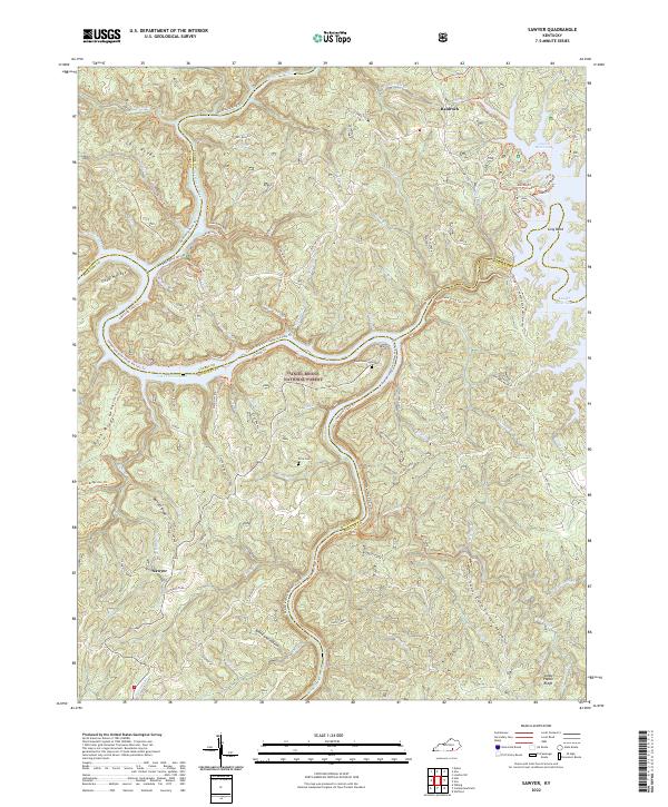
2022 Map of Sawyer
USGS Topo · Published 2022About this map
Daniel Boone National Forest dominates this landscape, where the convergence of the Rockcastle River and Lake Cumberland defines the local geography. The area around Sawyer and Baldrock is characterized by a series of high ridges, such as Gulf Ridge and Goodin Ridge, separated by a dense network of drainages including Sulphur Fork and Bark Camp Cr. Local history is preserved in family landmarks like Price Cem and Hamilton Cem, while the rugged terrain is navigated by a complex system of historical paths and modern routes including the Sheltowee Trace Trl and Rock Ridge Ohv Trl. The map illustrates the intersection of several county boundaries—Pulaski, McCreary, Laurel, and Whitley—underscoring the strategic regional position of these upland settlements and the natural waterways that bound them.
Find a feature on this map
78 named features on this map. Tap any name to fly to it.
Don’t see what you’re looking for? This feature index may not catch every label — zoom into the map to look around manually.
Map Details
Editions of this 2022 Sawyer Map
This is the sole edition of this map. No revisions or reprints were ever made.
Other maps of this area

1890 · Williamsburg
USGS Topo · 1:125,000

1893 · London
USGS Topo · 1:125,000

1894 · Williamsburg
USGS Topo · 1:125,000

1897 · London
USGS Topo · 1:125,000

1952 · Wofford
USGS Topo · 1:24,000

1952 · Hail
USGS Topo · 1:24,000

1952 · London SW
USGS Topo · 1:24,000

1952 · Vox
USGS Topo · 1:24,000

1952 · Ano
USGS Topo · 1:24,000

1952 · Wiborg
USGS Topo · 1:24,000