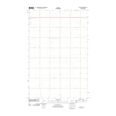
2011 Map of Sawyer NE
USGS Topo · Published 2011About this map
Agricultural lands northeast of Sawyer dominate this North Dakota landscape, defined by a rigid section-line road grid that characterizes the region's late-twentieth and early-twenty-first-century development. The Usgs records a sprawling network of numbered avenues and streets, such as 5th Ave NE and 125th St SE, which facilitate the movement of local crops and machinery. This survey captures a moment of modern rural continuity, where traditional land divisions meet the precision of satellite-derived mapping. The infrastructure consists primarily of local thoroughfares like 20th Ave SE and 153rd St SE, reflecting the sparse but steady settlement patterns of the Ward County plains. This map is essential for understanding the contemporary geography of the Missouri Plateau's northern reaches.
Find a feature on this map
16 named features on this map. Tap any name to fly to it.
Don’t see what you’re looking for? This feature index may not catch every label — zoom into the map to look around manually.
Map Details
Editions of this 2011 Sawyer NE Map
This is the sole edition of this map. No revisions or reprints were ever made.
Other maps of this area

1929 · Sawyer
USGS Topo · 1:62,500

1948 · Velva
USGS Topo · 1:62,500

1948 · Sawyer
USGS Topo · 1:24,000

1948 · Surrey
USGS Topo · 1:24,000

1949 · Norwich
USGS Topo · 1:24,000

1949 · Sawyer
USGS Topo · 1:24,000

1949 · Sawyer NE
USGS Topo · 1:24,000

1949 · Deering SW
USGS Topo · 1:24,000

1949 · Velva
USGS Topo · 1:24,000

1949 · Deering SE
USGS Topo · 1:24,000