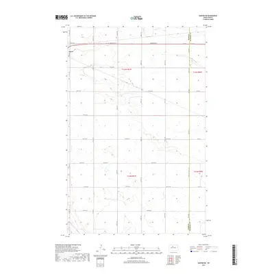
2017 Map of Sawyer NE
USGS Topo · Published 2017About this map
Surrey anchors the northwest corner of this North Dakota landscape, situated along the heavily traveled Burdick Expy E. The terrain is defined by the high plains of the Missouri Coteau, where the surface is dotted with numerous small wetlands and depressions typical of post-glacial geography. This 2017 survey reveals a highly organized section line road network, including 4th Ave Ne and 20th Ave Se, which parcel the land for agricultural use. The eastern edge of the sheet follows the administrative transition at the Ward Co and McHenry Co boundary. The map captures the quiet persistence of the prairie landscape, where long straightaways like 93rd Ave Se and 79th Ave Se connect the expansive farmsteads of the Souris River basin area.
Find a feature on this map
34 named features on this map. Tap any name to fly to it.
Don’t see what you’re looking for? This feature index may not catch every label — zoom into the map to look around manually.
Map Details
Editions of this 2017 Sawyer NE Map
This is the sole edition of this map. No revisions or reprints were ever made.
Other maps of this area

1929 · Sawyer
USGS Topo · 1:62,500

1948 · Velva
USGS Topo · 1:62,500

1948 · Sawyer
USGS Topo · 1:24,000

1948 · Surrey
USGS Topo · 1:24,000

1949 · Norwich
USGS Topo · 1:24,000

1949 · Sawyer
USGS Topo · 1:24,000

1949 · Sawyer NE
USGS Topo · 1:24,000

1949 · Deering SW
USGS Topo · 1:24,000

1949 · Velva
USGS Topo · 1:24,000

1949 · Deering SE
USGS Topo · 1:24,000