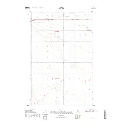
2020 Map of Sawyer NE
USGS Topo · Published 2020About this map
Surrey anchors the northwestern corner of this territory, where the suburban edge of the city meets the expansive agricultural grid of the North Dakota plains. The map illustrates a landscape defined by the Section Land Survey system, with roads like 4th Ave NE and 11th Ave SE following precise section lines across the prairie. A primary transportation corridor, Burdick Expy E, cuts east-west through the northern reach, serving as a vital link for the local rural economy. Along the eastern edge, the Ward Co McHenry Co line marks a political boundary that divides the land without disrupting the uniform pattern of drainage and cultivation. This map documents the intersection of expanding municipal development and traditional homestead grids, featuring numerous section roads such as 20th Ave SE and 79th Ave SE that provide access to the remote interior sections.
Find a feature on this map
19 named features on this map. Tap any name to fly to it.
Don’t see what you’re looking for? This feature index may not catch every label — zoom into the map to look around manually.
Map Details
Editions of this 2020 Sawyer NE Map
This is the sole edition of this map. No revisions or reprints were ever made.
Other maps of this area

1929 · Sawyer
USGS Topo · 1:62,500

1948 · Velva
USGS Topo · 1:62,500

1948 · Sawyer
USGS Topo · 1:24,000

1948 · Surrey
USGS Topo · 1:24,000

1949 · Norwich
USGS Topo · 1:24,000

1949 · Sawyer
USGS Topo · 1:24,000

1949 · Sawyer NE
USGS Topo · 1:24,000

1949 · Deering SW
USGS Topo · 1:24,000

1949 · Velva
USGS Topo · 1:24,000

1949 · Deering SE
USGS Topo · 1:24,000