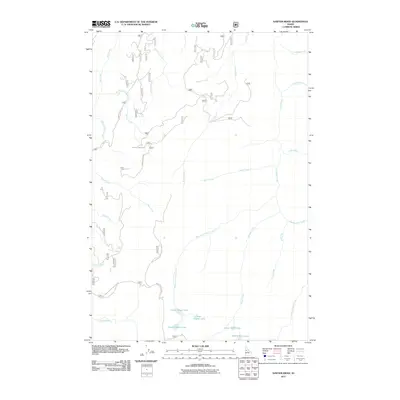
2011 Map of Sawyer Ridge
USGS Topo · Published 2011About this map
Upper Gospel Lake, Lower Gospel Lake, and East Gospel Lake gather in a high-elevation basin, serving as the headwaters for the extensive drainage network that defines this portion of Idaho County. The 2011 survey by the U.S. Geological Survey documents a landscape dominated by aquatic features and high-altitude timberlands, where Lower Knob Lake and Middle Knob Lake mark the southeastern boundaries of the quadrangle. Transportation is strictly limited to primitive corridors such as Hungry Ridge Rd and the Natl Forest Develop Road 444 Rd, which facilitate access into the Nez Perce National Forest. The intricate network of waterways, including Merron Creek and Marble Creek, reflects the region's steep hydrology. These labels and the presence of Moores Station Rd indicate the historical and contemporary use of the land for forestry and seasonal backcountry management.
Find a feature on this map
33 named features on this map. Tap any name to fly to it.
Don’t see what you’re looking for? This feature index may not catch every label — zoom into the map to look around manually.
Map Details
Editions of this 2011 Sawyer Ridge Map
This is the sole edition of this map. No revisions or reprints were ever made.
Other maps of this area

1931 · Buffalo Hump
USGS Topo · 1:125,000

1934 · Buffalo Hump
USGS Topo · 1:125,000

1955 · Grangeville
USGS Topo · 1:250,000

1956 · Elk City
USGS Topo · 1:250,000

1959 · Grangeville
USGS Topo · 1:250,000

1960 · Elk City
USGS Topo · 1:250,000

1963 · Sourdough Peak
USGS Topo · 1:24,000

1963 · Goodwin Meadows
USGS Topo · 1:24,000

1963 · Hanover Mtn.
USGS Topo · 1:24,000

1963 · Huddleson Bluff
USGS Topo · 1:24,000