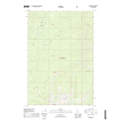
2020 Map of Sawyer Ridge
USGS Topo · Published 2020About this map
Nez Perce National Forest dominates this high-elevation Idaho landscape, defined by a series of prominent ridges and alpine basins. The terrain is structured by Sawyer Ridge and Hungry Ridge, which separate deep drainages like Johns Cr and Slate Cr. Notable for its concentration of high-country water bodies, the area includes the Gospel Lakes chain—comprising Lower Gospel Lake and East Gospel Lake—as well as the Knob Lakes group near Pyramid Point.
Find a feature on this map
40 named features on this map. Tap any name to fly to it.
Don’t see what you’re looking for? This feature index may not catch every label — zoom into the map to look around manually.
Map Details
Editions of this 2020 Sawyer Ridge Map
This is the sole edition of this map. No revisions or reprints were ever made.
Other maps of this area

1931 · Buffalo Hump
USGS Topo · 1:125,000

1934 · Buffalo Hump
USGS Topo · 1:125,000

1955 · Grangeville
USGS Topo · 1:250,000

1956 · Elk City
USGS Topo · 1:250,000

1959 · Grangeville
USGS Topo · 1:250,000

1960 · Elk City
USGS Topo · 1:250,000

1963 · Sourdough Peak
USGS Topo · 1:24,000

1963 · Goodwin Meadows
USGS Topo · 1:24,000

1963 · Hanover Mtn.
USGS Topo · 1:24,000

1963 · Huddleson Bluff
USGS Topo · 1:24,000