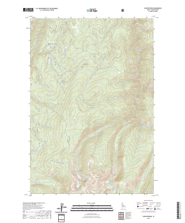
2024 Map of Sawyer Ridge
USGS Topo · Published 2024About this map
Moores Station serves as a lone human landmark amidst the expansive protected lands of the Gospel-Hump Wilderness and the Nez Perce National Forest. This high-altitude landscape is defined by the prominent spine of Sawyer Ridge and the steep slopes of Hungry Ridge to the northwest. The terrain is deeply incised by a network of drainages, including Mill Creek, American Creek, and Trout Creek, which flow from high points like Marble Point and Gospel Hill.
Find a feature on this map
41 named features on this map. Tap any name to fly to it.
Don’t see what you’re looking for? This feature index may not catch every label — zoom into the map to look around manually.
Map Details
Editions of this 2024 Sawyer Ridge Map
This is the sole edition of this map. No revisions or reprints were ever made.
Other maps of this area

1931 · Buffalo Hump
USGS Topo · 1:125,000

1934 · Buffalo Hump
USGS Topo · 1:125,000

1955 · Grangeville
USGS Topo · 1:250,000

1956 · Elk City
USGS Topo · 1:250,000

1959 · Grangeville
USGS Topo · 1:250,000

1960 · Elk City
USGS Topo · 1:250,000

1963 · Sourdough Peak
USGS Topo · 1:24,000

1963 · Goodwin Meadows
USGS Topo · 1:24,000

1963 · Hanover Mtn.
USGS Topo · 1:24,000

1963 · Huddleson Bluff
USGS Topo · 1:24,000