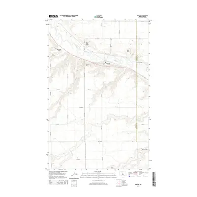
2014 Map of Sawyer
USGS Topo · Published 2014About this map
The town of Sawyer sits along a prominent bend in the Souris River, serving as a central hub for this portion of the northern plains. This 2014 survey illustrates the local infrastructure, including the Warren Pietsch Airport and the north-south boundary between Ward County and McHenry County. The landscape is defined by its drainage patterns, with Blackwater Coulee and Bonnes Coulee carving through the terrain toward the river valley. To the east, Schilling Bridge provides a crossing over the river, while local elevations like Skinner Hill and Black Butte rise above the surrounding agricultural grid. For those researching family history in the area, the location of the Sawyer Cemetery north of the main settlement offers a specific point of interest. The map also traces the winding path of Oak Creek as it moves through the southern reaches of the quadrangle.
Find a feature on this map
28 named features on this map. Tap any name to fly to it.
Don’t see what you’re looking for? This feature index may not catch every label — zoom into the map to look around manually.
Map Details
Editions of this 2014 Sawyer Map
This is the sole edition of this map. No revisions or reprints were ever made.
Other maps of this area

1929 · Sawyer
USGS Topo · 1:62,500

1929 · Benedict
USGS Topo · 1:62,500

1929 · Kongsberg
USGS Topo · 1:62,500

1948 · Velva
USGS Topo · 1:62,500

1948 · Sawyer
USGS Topo · 1:24,000

1948 · Surrey
USGS Topo · 1:24,000

1949 · Norwich
USGS Topo · 1:24,000

1949 · Sawyer
USGS Topo · 1:24,000

1949 · Sawyer NE
USGS Topo · 1:24,000

1949 · Velva
USGS Topo · 1:24,000