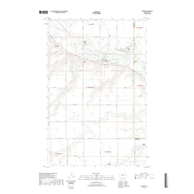
2017 Map of Sawyer
USGS Topo · Published 2017About this map
Sawyer serves as the central settlement on this North Dakota prairie landscape, situated along the Soo Line railroad corridor. The town's layout is defined by Railway St and the transition into the surrounding agricultural acreage of Ward and McHenry counties. The winding course of the Souris River cuts through the northern portion of the map, crossed by the Schilling Bridge and flanked by distinct terrain features like Blackwater Coulee and Skinner Hill. To the east, the prominent elevation of Black Butte provides a landmark for the region, now associated with Black Butte Adventures. Local history is anchored by the Sawyer Cem north of town and the Warren Pietsch Airport, while the southern reaches of the map are defined by the drainage patterns of Oak Cr and the draws of Bonnes Coulee.
Find a feature on this map
38 named features on this map. Tap any name to fly to it.
Don’t see what you’re looking for? This feature index may not catch every label — zoom into the map to look around manually.
Map Details
Editions of this 2017 Sawyer Map
This is the sole edition of this map. No revisions or reprints were ever made.
Other maps of this area

1929 · Sawyer
USGS Topo · 1:62,500

1929 · Benedict
USGS Topo · 1:62,500

1929 · Kongsberg
USGS Topo · 1:62,500

1948 · Velva
USGS Topo · 1:62,500

1948 · Sawyer
USGS Topo · 1:24,000

1948 · Surrey
USGS Topo · 1:24,000

1949 · Norwich
USGS Topo · 1:24,000

1949 · Sawyer
USGS Topo · 1:24,000

1949 · Sawyer NE
USGS Topo · 1:24,000

1949 · Velva
USGS Topo · 1:24,000