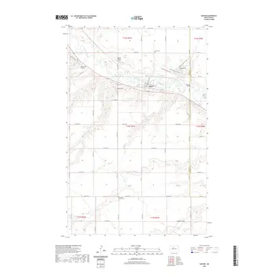
2020 Map of Sawyer
USGS Topo · Published 2020About this map
The Souris River meanders through this portion of Ward and McHenry counties, anchoring the town of Sawyer. This modern-era survey illustrates the intersection of traditional agricultural land divisions and contemporary local infrastructure, including the Warren Pietsch Airport. The landscape is defined by its drainage patterns, with Blackwater Coulee and Bonnés Coulee cutting through the terrain toward the river valley. Genealogists will find several burial sites preserved on the landscape, such as Sawyer Cem, the Skinner Cem, and the Mennonite Brethren Cem located further south. Transportation routes are well-defined, from the rail line serving the town to the river crossing at Schilling Bridge, showing how the community remains tied to its geography.
Find a feature on this map
36 named features on this map. Tap any name to fly to it.
Don’t see what you’re looking for? This feature index may not catch every label — zoom into the map to look around manually.
Map Details
Editions of this 2020 Sawyer Map
This is the sole edition of this map. No revisions or reprints were ever made.
Other maps of this area

1929 · Sawyer
USGS Topo · 1:62,500

1929 · Benedict
USGS Topo · 1:62,500

1929 · Kongsberg
USGS Topo · 1:62,500

1948 · Velva
USGS Topo · 1:62,500

1948 · Sawyer
USGS Topo · 1:24,000

1948 · Surrey
USGS Topo · 1:24,000

1949 · Norwich
USGS Topo · 1:24,000

1949 · Sawyer
USGS Topo · 1:24,000

1949 · Sawyer NE
USGS Topo · 1:24,000

1949 · Velva
USGS Topo · 1:24,000