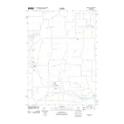
2010 Map of Saxeville
USGS Topo · Published 2010About this map
The Pine River flows through the heart of this Waushara County landscape, where the small settlements of Saxeville and the village of Pine River serve as local anchors. Water management is a defining characteristic of the area, evidenced by the presence of several named water control structures including the Clarks Mill Dam and the Pine River 3WR1564 Dam. These sites, along with the Mill Pond and several glacially-formed lakes like Big Cedar Lake and Little Cedar Lake, illustrate how early 21st-century rural Wisconsin utilized its local hydrology for community and agricultural purposes.
Find a feature on this map
69 named features on this map. Tap any name to fly to it.
Don’t see what you’re looking for? This feature index may not catch every label — zoom into the map to look around manually.
Map Details
Editions of this 2010 Saxeville Map
This is the sole edition of this map. No revisions or reprints were ever made.
Other maps of this area

1955 · Green Bay
USGS Topo · 1:250,000

1956 · Weyauwega
USGS Topo · 1:48,000

1957 · Waupaca
USGS Topo · 1:48,000

1961 · Poy Sippi
USGS Topo · 1:62,500

1961 · Redgranite
USGS Topo · 1:62,500

1961 · Saxeville
USGS Topo · 1:24,000

1961 · Wild Rose
USGS Topo · 1:24,000
1961 · Redgranite
USGS Topo · 1:24,000
1961 · Auroraville
USGS Topo · 1:24,000

1961 · Spring Lake
USGS Topo · 1:24,000