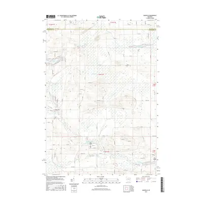
2015 Map of Saxeville
USGS Topo · Published 2015About this map
The Pine River and its accompanying Pine River Millpond define the southern landscape of this central Wisconsin region, where the eponymous settlement of Pine River serves as a local hub. The map illustrates a transitional landscape where agriculture and woodland meet the marshy corridors of Carpenter Creek and Magdanz Creek. To the west, the village of Saxeville is established near Hilltop Cemetery, while the village of Poy Sippi sits at the southeastern corner.
Find a feature on this map
93 named features on this map. Tap any name to fly to it.
Don’t see what you’re looking for? This feature index may not catch every label — zoom into the map to look around manually.
Map Details
Editions of this 2015 Saxeville Map
This is the sole edition of this map. No revisions or reprints were ever made.
Other maps of this area

1955 · Green Bay
USGS Topo · 1:250,000

1956 · Weyauwega
USGS Topo · 1:48,000

1957 · Waupaca
USGS Topo · 1:48,000

1961 · Poy Sippi
USGS Topo · 1:62,500

1961 · Redgranite
USGS Topo · 1:62,500

1961 · Saxeville
USGS Topo · 1:24,000

1961 · Wild Rose
USGS Topo · 1:24,000
1961 · Redgranite
USGS Topo · 1:24,000
1961 · Auroraville
USGS Topo · 1:24,000

1961 · Spring Lake
USGS Topo · 1:24,000