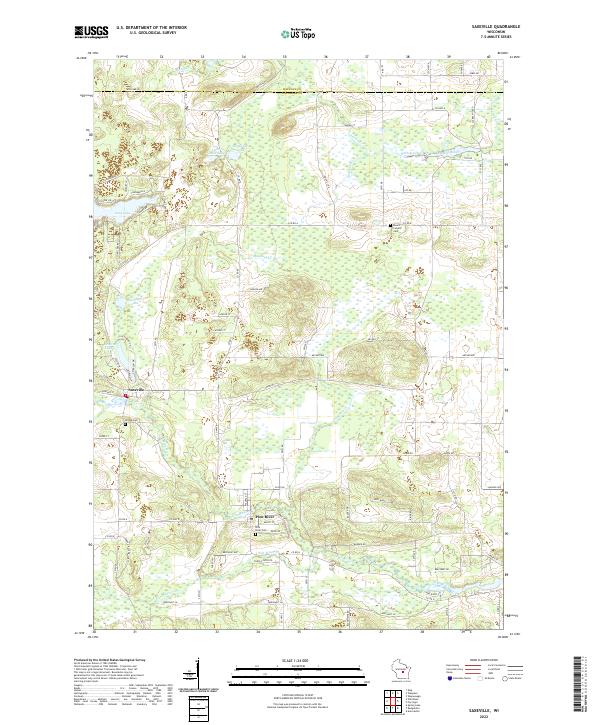
2022 Map of Saxeville
USGS Topo · Published 2022About this map
Saxeville and Pine River serve as the primary community hubs in this rural landscape near the Waupaca and Waushara county line. The region is defined by a dense network of water bodies, including Long Lake, Little Cedar Lake, and the winding Pine River itself. The presence of the Mill Pond and Hatton Creek indicates a history of water-based utility or industry, while the numerous cemeteries like Hilltop Cem and Mount Calvary Cem provide significant points of interest for genealogical research.
Find a feature on this map
90 named features on this map. Tap any name to fly to it.
Don’t see what you’re looking for? This feature index may not catch every label — zoom into the map to look around manually.
Map Details
Editions of this 2022 Saxeville Map
This is the sole edition of this map. No revisions or reprints were ever made.
Other maps of this area

1955 · Green Bay
USGS Topo · 1:250,000

1956 · Weyauwega
USGS Topo · 1:48,000

1957 · Waupaca
USGS Topo · 1:48,000

1961 · Poy Sippi
USGS Topo · 1:62,500

1961 · Redgranite
USGS Topo · 1:62,500

1961 · Saxeville
USGS Topo · 1:24,000

1961 · Wild Rose
USGS Topo · 1:24,000
1961 · Redgranite
USGS Topo · 1:24,000
1961 · Auroraville
USGS Topo · 1:24,000

1961 · Spring Lake
USGS Topo · 1:24,000