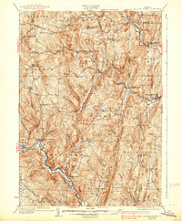
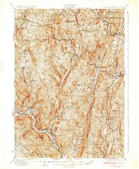
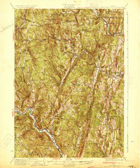
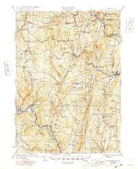
1933 Map of Saxtons River
USGS Topo · Published 1938About this map
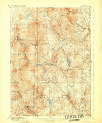
Grafton and Saxtons River anchor this late 1920s survey of Windham County, where the narrow valleys of the Williams River and West River dictated the early Vermont settlement patterns. The landscape is defined by its steep hills and the river-based economies of small villages like Brockway Mills and Bartonsville. The Rutland railroad winds through the northeast corner, following the riverbeds that provided the only level ground for transit through the higher elevations of Windmill Mountain and Round Mtn.
Find a feature on this map
103 named features on this map. Tap any name to fly to it.
Don’t see what you’re looking for? This feature index may not catch every label — zoom into the map to look around manually.
Map Details
Editions of this 1933 Saxtons River Map
4 editions found
Other maps of this area

1889 · Wilmington
USGS Topo · 1:62,500

1891 · Wilmington
USGS Topo · 1:62,500

1891 · Brattleboro
USGS Topo · 1:62,500

1893 · Wallingford
USGS Topo · 1:62,500

1893 · Brattleboro
USGS Topo · 1:62,500

1894 · Londonderry
USGS Topo · 1:62,500

1898 · Keene
USGS Topo · 1:62,500

1899 · Londonderry
USGS Topo · 1:62,500
1899 · Wilmington
USGS Topo · 1:62,500

1926 · Claremont
USGS Topo · 1:62,500