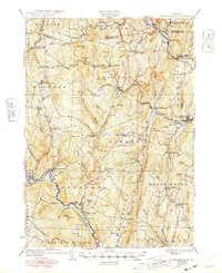
1933 Map of Saxtons River
USGS Topo · Published 1948About this map
Grafton and Saxtons River anchor this late 1920s survey of Windham County, showing a landscape defined by steep hills and the winding corridors of the West River and Saxtons River. The settlement pattern reveals a series of compact villages and upland crossroads like Windham Center, where the Windham Center Ch stands as a local landmark. A dense network of district schools, such as the Pettengill Sch and Walker Sch, indicates the distributed rural population of the era before the consolidation of the mid-20th century.
Find a feature on this map
115 named features on this map. Tap any name to fly to it.
Don’t see what you’re looking for? This feature index may not catch every label — zoom into the map to look around manually.
Map Details
Editions of this 1933 Saxtons River Map
4 editions found

Other maps of this area

1889 · Wilmington
USGS Topo · 1:62,500

1891 · Wilmington
USGS Topo · 1:62,500

1891 · Brattleboro
USGS Topo · 1:62,500

1893 · Wallingford
USGS Topo · 1:62,500

1893 · Brattleboro
USGS Topo · 1:62,500

1894 · Londonderry
USGS Topo · 1:62,500

1898 · Keene
USGS Topo · 1:62,500

1899 · Londonderry
USGS Topo · 1:62,500

1899 · Wilmington
USGS Topo · 1:62,500

1926 · Claremont
USGS Topo · 1:62,500