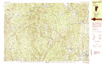
1984 Map of Saxtons River
USGS Topo · Published 1984About this map
Grafton and the village of Saxtons River anchor this mid-1980s landscape, where the winding water of the Saxtons River and its South Branch dictate the settlement pattern of Windham County. The terrain is defined by named peaks such as Sugarloaf, Bear Hill, and Timber Ridge Mtn, which separate small upland hamlets like Houghtonville and North Windham.
Find a feature on this map
63 named features on this map. Tap any name to fly to it.
Don’t see what you’re looking for? This feature index may not catch every label — zoom into the map to look around manually.
Map Details
Editions of this 1984 Saxtons River Map
2 editions found
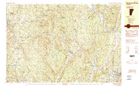
Other maps of this area

1893 · Wallingford
USGS Topo · 1:62,500

1894 · Londonderry
USGS Topo · 1:62,500

1899 · Londonderry
USGS Topo · 1:62,500

1926 · Claremont
USGS Topo · 1:62,500

1927 · Bellows Falls
USGS Topo · 1:48,000

1928 · Ludlow
USGS Topo · 1:48,000

1929 · Claremont
USGS Topo · 1:62,500

1929 · Ludlow
USGS Topo · 1:62,500

1930 · Saxtons River
USGS Topo · 1:48,000

1930 · Bellows Falls
USGS Topo · 1:62,500