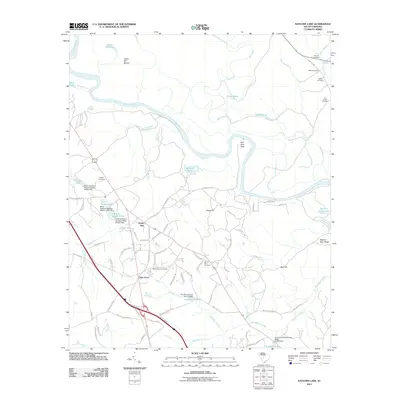
2011 Map of Saylors Lake
USGS Topo · Published 2011About this map
Sandy Run and Oak Grove anchor this portion of the South Carolina Midlands, where the landscape transitions from managed forest and farmland into the alluvial bottomlands of the Congaree River. The river's winding course is marked by numerous oxbows and swampy features such as Saylors Lake, Roundabout Lake, and Goose Pond, reflecting the complex hydrology of the floodplains. To the north, Green Hill Mound rises above the low-lying terrain near Green Hill Lake, hinting at the area's ancient topographic significance.
Find a feature on this map
87 named features on this map. Tap any name to fly to it.
Don’t see what you’re looking for? This feature index may not catch every label — zoom into the map to look around manually.
Map Details
Editions of this 2011 Saylors Lake Map
This is the sole edition of this map. No revisions or reprints were ever made.
Other maps of this area

1944 · Edmund
USGS Topo · 1:62,500

1946 · Woodford
USGS Topo · 1:62,500

1946 · St. Matthews
USGS Topo · 1:62,500

1948 · Hopkins
USGS Topo · 1:62,500

1953 · Saylors Lake
USGS Topo · 1:24,000

1953 · Fort Jackson South
USGS Topo · 1:24,000
1953 · Congaree
USGS Topo · 1:24,000

1953 · Gadsden
USGS Topo · 1:24,000

1954 · Augusta
USGS Topo · 1:250,000

1957 · Augusta
USGS Topo · 1:250,000