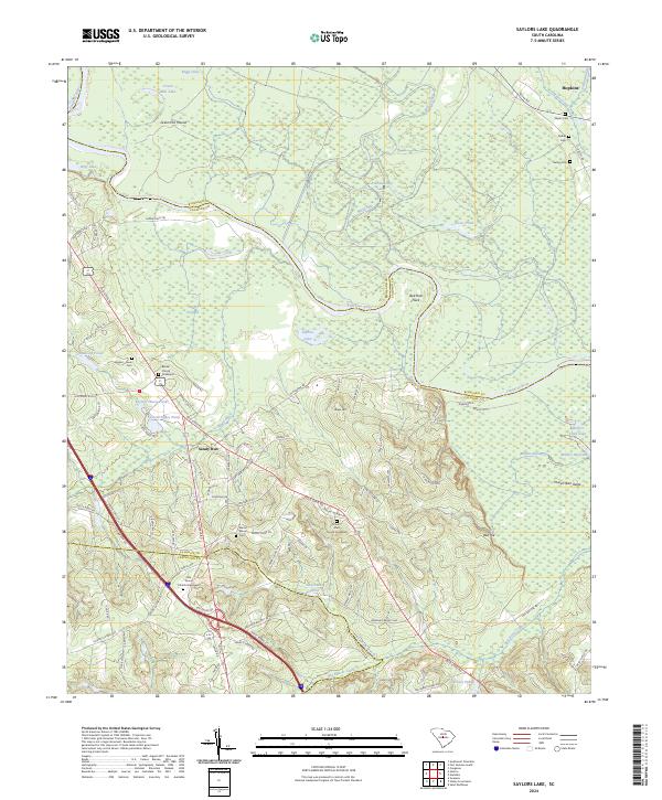
2024 Map of Saylors Lake
USGS Topo · Published 2024About this map
The Congaree River meanders across the border of Richland and Calhoun counties, creating a complex landscape of wetlands and oxbows such as Roundabout Lake and Saylors Lake. On the southern banks, the community of Sandy Run serves as a focal point for local history, surrounded by numerous family and church burial sites including the Kaigler - Davis Cem and the Beulah Church Graveyard. The topography rises sharply from the river bottomlands toward Haigs Hill and Red Hill, where the network of early transportation routes like the Old State Rd once facilitated travel through this agricultural corridor.
Find a feature on this map
102 named features on this map. Tap any name to fly to it.
Don’t see what you’re looking for? This feature index may not catch every label — zoom into the map to look around manually.
Map Details
Editions of this 2024 Saylors Lake Map
This is the sole edition of this map. No revisions or reprints were ever made.
Other maps of this area

1944 · Edmund
USGS Topo · 1:62,500

1946 · Woodford
USGS Topo · 1:62,500

1946 · St. Matthews
USGS Topo · 1:62,500

1948 · Hopkins
USGS Topo · 1:62,500

1953 · Saylors Lake
USGS Topo · 1:24,000

1953 · Fort Jackson South
USGS Topo · 1:24,000
1953 · Congaree
USGS Topo · 1:24,000

1953 · Gadsden
USGS Topo · 1:24,000

1954 · Augusta
USGS Topo · 1:250,000

1957 · Augusta
USGS Topo · 1:250,000