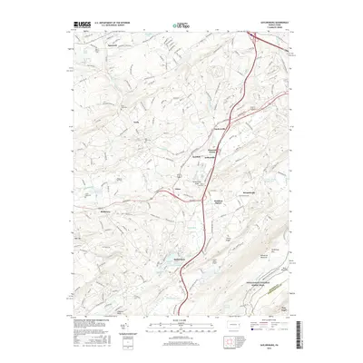
2016 Map of Saylorsburg
USGS Topo · Published 2016About this map
The Kellersville Esker rises from the landscape near Sciota, a prominent glacial feature in this section of Monroe County. This 2016 survey illustrates the persistent agricultural and small-town character of the region, where older hamlets like Appenzell, Neola, and Bossardsville are linked by a network of rural roads such as Appenzell Rd and Hamilton Rd E. The drainage patterns are clearly defined by McMichael Creek and Cherry Cr, which flow through valleys beneath the prominent ridge of Kittatinny Mtn.
Find a feature on this map
172 named features on this map. Tap any name to fly to it.
Don’t see what you’re looking for? This feature index may not catch every label — zoom into the map to look around manually.
Map Details
Editions of this 2016 Saylorsburg Map
This is the sole edition of this map. No revisions or reprints were ever made.
Other maps of this area

1891 · Delaware Water Gap
USGS Topo · 1:62,500

1893 · Delaware Water Gap
USGS Topo · 1:62,500

1914 · Wind Gap
USGS Topo · 1:62,500

1916 · Wind Gap
USGS Topo · 1:62,500

1919 · Pocono
USGS Topo · 1:62,500

1921 · Pocono
USGS Topo · 1:62,500

1923 · Pocono
USGS Topo · 1:62,500

1924 · Bushkill
USGS Topo · 1:48,000

1936 · Delaware Water Gap
USGS Topo · 1:48,000

1941 · Delaware Water Gap
USGS Topo · 1:62,500
Featured Places
- Stroud Township, PA
- Pocono Township, PA
- Plainfield Township, PA
- Hamilton Township, PA
- Jackson Township, PA