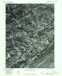
1976 Map of Saylorsburg
USGS Topo · Published 1978About this map
Saylorsburg and the surrounding Monroe County terrain are captured in this mid-1970s orthophotoquad, which uses rectified aerial imagery to show the actual land use and vegetation patterns of the era. The settlement of Sciota sits along the winding corridor that connects these rural communities, with the photographic detail revealing the precise footprint of farmsteads, woodlots, and road networks that topographic lines alone cannot convey.
Find a feature on this map
4 named features on this map. Tap any name to fly to it.
Don’t see what you’re looking for? This feature index may not catch every label — zoom into the map to look around manually.
Map Details
Editions of this 1976 Saylorsburg Map
This is the sole edition of this map. No revisions or reprints were ever made.
Other maps of this area

1891 · Delaware Water Gap
USGS Topo · 1:62,500

1893 · Delaware Water Gap
USGS Topo · 1:62,500

1914 · Wind Gap
USGS Topo · 1:62,500

1916 · Wind Gap
USGS Topo · 1:62,500

1919 · Pocono
USGS Topo · 1:62,500

1921 · Pocono
USGS Topo · 1:62,500

1923 · Pocono
USGS Topo · 1:62,500

1924 · Bushkill
USGS Topo · 1:48,000

1936 · Delaware Water Gap
USGS Topo · 1:48,000

1941 · Delaware Water Gap
USGS Topo · 1:62,500
Featured Places
- Plainfield Township, PA
- Chestnuthill Township, PA
- Pocono Township, PA
- Sciota, Hamilton Township
- Stroud Township, PA