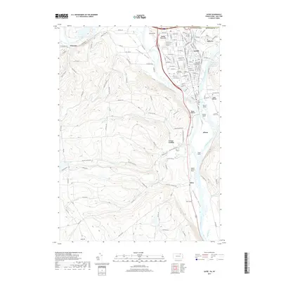
2019 Map of Sayre
USGS Topo · Published 2019About this map
Tioga Point marks the convergence of the Chemung River and the Susquehanna River, a landform that has historically dictated the settlement patterns of this border region between New York and Pennsylvania. The river valley is densely occupied by the contiguous communities of Sayre, South Waverly, and Athens, while the surrounding terrain features landmarks like the prominent Spanish Hill and the Queen Esther Flats. This 2019 survey documents a landscape where modern industry at the Gateway Industrial Park Rd sits alongside numerous historic burial grounds, including the Old Athens Cem and the Church of the Redeemer Columbarium. The network of small waterways, such as Tutelow Cr, Wolcott Cr, and Satterlee Cr, drain the high ground into the Sheshequin Valley, reflecting a geography that continues to support a mix of residential centers and rural uplands.
Find a feature on this map
122 named features on this map. Tap any name to fly to it.
Don’t see what you’re looking for? This feature index may not catch every label — zoom into the map to look around manually.
Map Details
Editions of this 2019 Sayre Map
This is the sole edition of this map. No revisions or reprints were ever made.
Other maps of this area

1902 · Waverly
USGS Topo · 1:62,500

1903 · Owego
USGS Topo · 1:62,500

1905 · Watkins Glen
USGS Topo · 1:125,000

1906 · Catatonk
USGS Topo · 1:125,000

1923 · Towanda
USGS Topo · 1:62,500

1926 · Towanda
USGS Topo · 1:62,500

1939 · Sayre
USGS Topo · 1:62,500

1942 · Sayre
USGS Topo · 1:62,500

1943 · Towanda
USGS Topo · 1:62,500

1948 · Sayre
USGS Topo · 1:62,500