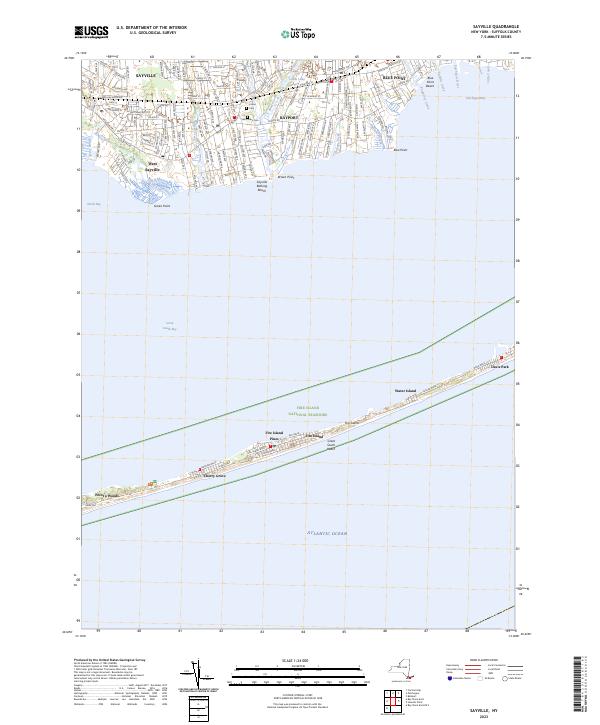
2023 Map of Sayville
USGS Topo · Published 2023About this map
Sayville and its neighboring South Shore hamlets are defined by their intricate relationship with the Great South Bay and the protective barrier of Fire Island. This modern survey reveals a landscape of established suburban blocks and protected marshlands, including the Wertheim National Wildlife Refuge and the Fire Island National Seashore. On the mainland, the map details the residential grids of Bayport and Blue Point, punctuated by local landmarks like Union Cem and Saint Ann's Cem.
Find a feature on this map
45 named features on this map. Tap any name to fly to it.
Don’t see what you’re looking for? This feature index may not catch every label — zoom into the map to look around manually.
Map Details
Editions of this 2023 Sayville Map
This is the sole edition of this map. No revisions or reprints were ever made.
Other maps of this area

1902 · Setauket
USGS Topo · 1:62,500

1902 · Fire Island
USGS Topo · 1:62,500

1903 · Fire Island
USGS Topo · 1:62,500

1904 · Setauket
USGS Topo · 1:62,500

1904 · Islip
USGS Topo · 1:125,000

1904 · Moriches
USGS Topo · 1:62,500

1919 · Setauket
USGS Topo · 1:62,500

1942 · Islip
USGS Topo · 1:125,000

1944 · Bay Shore East
USGS Topo · 1:24,000

1947 · Bellport
USGS Topo · 1:24,000